Areospace
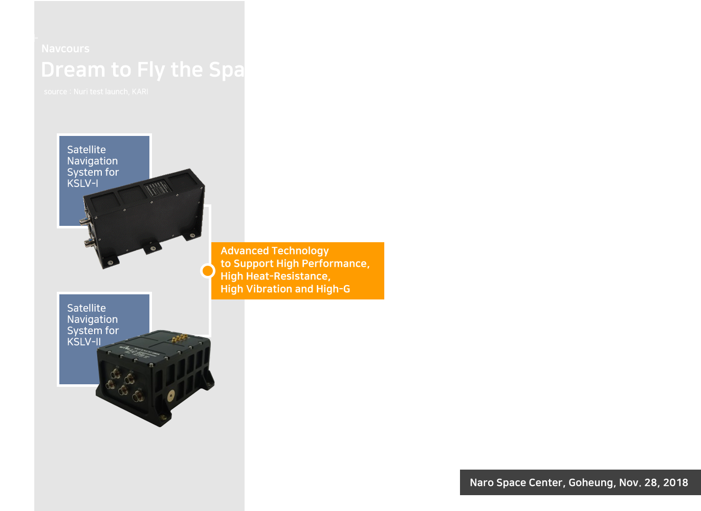
GNSS Navigation System for Korean Satellite Launcher

Navcours provides the specialized GNNS system for Korea Stellite Launching Vehicles, which is the advanced space technology owned by only 10 countries around the world. Now we, along with the Korea Aerospace Research Institute, are responsible for the multi-band GNSS system to be applied to satellite projectile under harsh environments, based on the success of the Nuri test launch vehicle in November 2018, following the Naro in 2013.
Performance
Configuration
- 3 Antennas and Multi-Band GNSS Receiver
- GPS L1/L5, GLONASS L1, Galileo E1b/E5a
- 10Hz
- <230x200x150mm, <3.5kg, <60w
- 30dB TYP.
- <110x110X31 mm, <0.4kg
Areospace
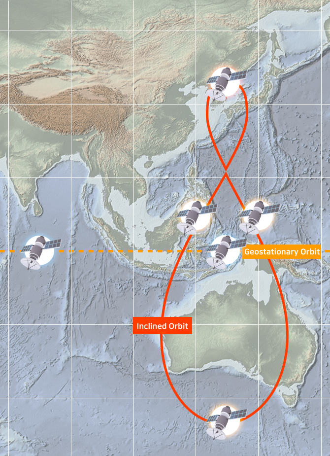
Korean Positioning System (KPS) Development and Expected Effects
KPS is a government-led project that maximizes the national safety guarantee in connection with the national network and PNT-based value added in the 4th Industrial Revolution.
Navcours will preemptively prepare for KPS development and promotion, and will lead the Korean satellite service sector by providing high-precision location information such as defense, autonomous driving, surveying, and public safety.
Navcours will preemptively prepare for KPS development and promotion, and will lead the Korean satellite service sector by providing high-precision location information such as defense, autonomous driving, surveying, and public safety.
Development Schedule
- [Preliminary Research '18 ~ ‘20]
Establishment of Construction Strategy and Preliminary Feasibility Study - [Phase 1 '22 ~ '24]
Ground Model Core Technology/Integrated Technology/Frequency Securing - [Phase 2, '24 ~ '28]
Development of 1st Orbital Navigation Satellite and Ground Station - [3rd phase '29 ~ '34]
Launch and Service of Each Inclined Geosynchronous and Geostationary Satellite - [Service ‘35 years]
Launched FOC (Full Operational Ability)
Areospace
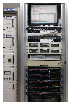
Continuous DGNSS Operation Services with Integrity based on Reliability and Efficiency
GNSS satellite signals contain various error components. As a way to eliminate these errors, DGNSS correction information is provided by the National Positioning Information Service.
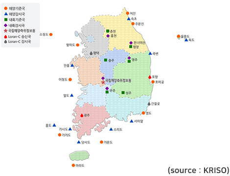
The DGNSS system performs the function of generating the correction information and broadcasting to the user by observing GNSS error components at the reference stations distributed nationwide.
In order to obtain accurate and stable positioning information, we have built a system that provides continuous DGNSS correction information.
Reference Station / Monitoring Station Server Rack
Ochungdo Reference
Station
Reference Station / Monitoring Station Antenna

Geomundo Reference Station
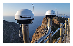
Dokdo Monitoring Station
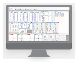
RSIM Operation
S / W
DGNSS Facility Status
Features
- Supporting Differentiated DGNSS System by Localized Domestic Technology
- Acquired K-RSIM (Reference Station and Integrity Monitoring) Technology from KRISO and Secured System Reliability
- Providing kinds of International Standard Message such as RSIM & RTCM
- Operating with Various GNSS Receivers
- Providing the Customized User Interface Configuration Reflecting Operator's Opinion
- Easy to Add Functions and Maintain
Applications
Navigation System, Traffic, Disaster, Geography, Surveying, Agriculture, Forestry Management, etc.
Please contact us for more information about the product.
E-MAIL : sales@navcours.com /
TEL : +82-42-363-9000
E-MAIL : sales@navcours.com /
TEL : +82-42-363-9000